Industrial History Online
Mortlake Brewery (Stag Brewery)
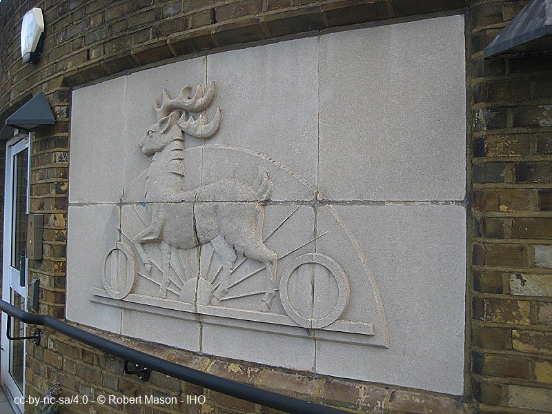
Key Words :- brewery
Address :- Lower Richmond Road, London, Greater London, SW14
Grid Ref :- TQ 2049 7593
Co-ordinates :- Lat 51.469518 , Long -0.266691
Local Authority :- Richmond upon Thames London Borough Council
Pre 1974 County :- Surrey
Site Status :- Site extant - No Protection
Site Condition :- Site disused - but otherwise substantially intact
Site Dates :- - 2015
Description and History of Site:-
Complex development with riverside facilities.
The brewery closed in December 2015. After standing vacant for almost a decade, the site is being transformed into 1,075 new homes, alongside a new secondary school with sixth form. The scheme also includes over 10,000 square metres of commercial space.
Mortlake brewery occupies a long, roughly triangular-shaped site to the west of the town centre of Mortlake. The site stretches along the south bank of the River Thames. Its eastern boundary is Bull's Alley, a short pedestrian route which leads from the town to the river. To the south is the High Street and Lower Richmond Road, and to the west of the site is William's Lane. Ship Lane which up to mid 20th century denoted the western boundary of the site now divides it. In the south-western corner of the site is a large open sports field.
Further Reading and References:-
Ashdown, John; Bussell, Michael; Carter, Paul. 'A Survey of Industrial Monuments of Greater London'. Thames Basin Archaeological Observers' Group, 1969
Stag Brewery Historic Buildings Report, Donald Insall Associates Ltd, 2009
https://stag-brewery.co.uk/
https://www.mortlake-history.org.uk/BandMmap/brewery.html
https://www.mortlake-history.org.uk/brewery.html
https://www.mbcg.org.uk/
https://www.layersoflondon.org/map/records/thames-street
https://www.kewsociety.org/update/mortlake-stag-brewery-redevelopment/
https://www.theguardian.com/business/2016/dec/07/mortlake-brewery-luxury-flats-abinbev-south-west-london-auction
Help us improve this entry
Grid Ref :- TQ 2049 7593
Co-ordinates :- Lat 51.469518 , Long -0.266691
Local Authority :- Richmond upon Thames London Borough Council
Pre 1974 County :- Surrey
Site Status :- Site extant - No Protection
Site Condition :- Site disused - but otherwise substantially intact
Site Dates :- - 2015
Complex development with riverside facilities.
The brewery closed in December 2015. After standing vacant for almost a decade, the site is being transformed into 1,075 new homes, alongside a new secondary school with sixth form. The scheme also includes over 10,000 square metres of commercial space.
Mortlake brewery occupies a long, roughly triangular-shaped site to the west of the town centre of Mortlake. The site stretches along the south bank of the River Thames. Its eastern boundary is Bull's Alley, a short pedestrian route which leads from the town to the river. To the south is the High Street and Lower Richmond Road, and to the west of the site is William's Lane. Ship Lane which up to mid 20th century denoted the western boundary of the site now divides it. In the south-western corner of the site is a large open sports field.
Ashdown, John; Bussell, Michael; Carter, Paul. 'A Survey of Industrial Monuments of Greater London'. Thames Basin Archaeological Observers' Group, 1969
Stag Brewery Historic Buildings Report, Donald Insall Associates Ltd, 2009
https://stag-brewery.co.uk/
https://www.mortlake-history.org.uk/BandMmap/brewery.html
https://www.mortlake-history.org.uk/brewery.html
https://www.mbcg.org.uk/
https://www.layersoflondon.org/map/records/thames-street
https://www.kewsociety.org/update/mortlake-stag-brewery-redevelopment/
https://www.theguardian.com/business/2016/dec/07/mortlake-brewery-luxury-flats-abinbev-south-west-london-auction
The compilers welcome corrections or additional information on all sites.
Any information provided will be verified before appearing on the web site.
Email comments
Contributor :- GLIAS Database - 2 June 2018
Copyright :- cc-by-nc-sa 4.0 © GLIAS Database
Copyright :- cc-by-nc-sa 4.0 © GLIAS Database