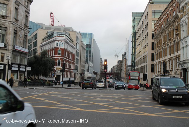
Farringdon Road (formerly Victoria St)
Record Visibility is - Public
Record Status - Incomplete/Unreviewed Site Record

Site ID :- GTL00428
Key Words :- road
Linked Sites :-Address :- London, Greater London, EC1
Grid Reference :- TQ 31019 82512
Grid Co-ordinates :- Easting 531019 m, Northing 182512 m
Lat & Long (WGS84) :- 51.52633 , -0.112748
View Historic Mapping
Site Location :-
Viewing Site :-
Parish or Township :-
Administrative Area :-
Islington London Borough Council
Pre 1974 County :- Greater London Council
Site Status :-
Site Condition :-
Site Era :-
Site Dates :- -
Visit By :- -
Contributor :- GLIAS Database - 2 June 2018
Contributors Society :- Greater London Industrial Archaeology Society
Copyright :- cc-by-nc-sa 4.0 © GLIAS Database
Record Status :- Incomplete
Reviewed By :- -
Description and History
Driven through slums of Fleet valley from Holborn Bridge to Bakers Row, 316816-312812, by the City of London, between 1840 and 1856, opening route from Blackfriars Bridge to King's Cross. Cuttings of Met.R (qv) then devastated area until 1860. Metropolitan street improvements
Further Reading and References
No references provided
Previous Comments:-
--- the following annotation is from Bob Rust, GLIAS :
GR TQ 31029 82566 (N) to TQ 31564 81669 (S) - Robert Mason - 30 April 2022
Note:- these comments have NOT been REVIEWED
Grid Reference :- TQ 31019 82512
Grid Co-ordinates :- Easting 531019 m, Northing 182512 m
Lat & Long (WGS84) :- 51.52633 , -0.112748
View Historic Mapping
Site Location :-
Viewing Site :-
Parish or Township :-
Administrative Area :- Islington London Borough Council
Pre 1974 County :- Greater London Council
Site Status :-
Site Condition :-
Site Era :-
Site Dates :- -
Visit By :- -
Contributor :- GLIAS Database - 2 June 2018
Contributors Society :- Greater London Industrial Archaeology Society
Copyright :- cc-by-nc-sa 4.0 © GLIAS Database
Record Status :- Incomplete
Reviewed By :- -