Industrial History Online
Turnpike boundary
Key Words :- road sign
Address :- Kettle's Yard, Castle Street, Cambridge, Cambridgeshire
Grid Ref :- TL 44569 59085
Co-ordinates :- Lat 52.211025 , Long 0.11447
Local Authority :- Cambridge City Council
Pre 1974 County :- Cambridgeshire
Site Status :- Site extant - No Protection
Description and History of Site:-
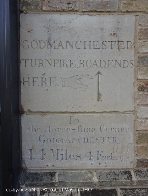
Upper stone:
GODMANCHESTER.
TURNPIKE.ROAD.ENDS.
HERE
Lower stone:
To
the Horse-shoe Corner
GODMANCHESTER
14 Miles 4 Furlongs
Originally set at coachman's eye level, however, both stones were moved to ground floor level when the building was renovated in 2016.
Original location: TL 4442 5929
Further Reading and References:-
Alderton, David and Booker, John. 'The Batsford Guide to the Industrial Archaeology of East Anglia'. Batsford, 1980
https://capturingcambridge.org/castle/kettles-yard/
Help us improve this entry
Grid Ref :- TL 44569 59085
Co-ordinates :- Lat 52.211025 , Long 0.11447
Local Authority :- Cambridge City Council
Pre 1974 County :- Cambridgeshire
Site Status :- Site extant - No Protection
Upper stone:
GODMANCHESTER.
TURNPIKE.ROAD.ENDS.
HERE
Lower stone:
To
the Horse-shoe Corner
GODMANCHESTER
14 Miles 4 Furlongs
Originally set at coachman's eye level, however, both stones were moved to ground floor level when the building was renovated in 2016.
Original location: TL 4442 5929
Alderton, David and Booker, John. 'The Batsford Guide to the Industrial Archaeology of East Anglia'. Batsford, 1980
https://capturingcambridge.org/castle/kettles-yard/
The compilers welcome corrections or additional information on all sites.
Any information provided will be verified before appearing on the web site.
Email comments
Contributor :- Cambridge IAG - 18 October 2022
Copyright :- cc-by-nc-sa 4.0 © Cambridge IAG
Copyright :- cc-by-nc-sa 4.0 © Cambridge IAG