Industrial History Online
Nether Bridge
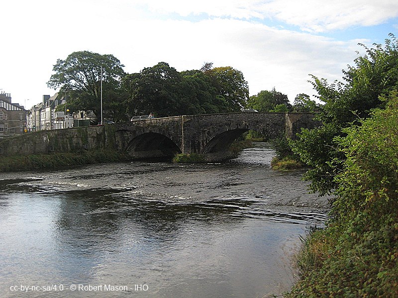
Key Words :- bridge
Address :- Kendal, Cumbria
Grid Ref :- SD 51669 91939
Co-ordinates :- Lat 54.320731 , Long -2.744531
Local Authority :- Westmorland and Furness Council
Pre 1974 County :- Westmorland
Site Status :- Scheduled Ancient Monument SAM
Historic England List No :- 1007110,
Description and History of Site:-
Site Description and History Under Review
Further Reading and References:-
Bennett, John and Jan. 'A Guide to the Industrial Archaeology of Cumbria'. Association for Industrial Archaeology, 1993
https://www.lancaster.ac.uk/quakers/links/kendal_netherb.html
Help us improve this entry
Grid Ref :- SD 51669 91939
Co-ordinates :- Lat 54.320731 , Long -2.744531
Local Authority :- Westmorland and Furness Council
Pre 1974 County :- Westmorland
Site Status :- Scheduled Ancient Monument SAM
Historic England List No :- 1007110,
Site Description and History Under Review
Bennett, John and Jan. 'A Guide to the Industrial Archaeology of Cumbria'. Association for Industrial Archaeology, 1993
https://www.lancaster.ac.uk/quakers/links/kendal_netherb.html
The compilers welcome corrections or additional information on all sites.
Any information provided will be verified before appearing on the web site.
Email comments
Contributor :- Robert Mason - 11 October 2023
Copyright :- cc-by-nc-sa 4.0 © Robert Mason
Copyright :- cc-by-nc-sa 4.0 © Robert Mason