Industrial History Online
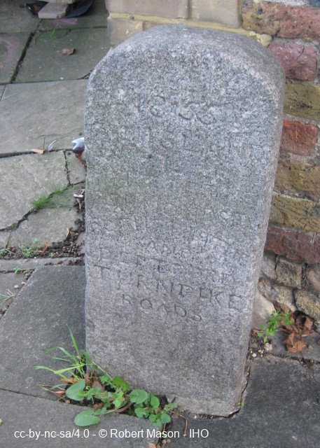
Turnpike Stone
Key Words :- turnpike
Address :- Grove Street, London, Greater London, SE8
Grid Ref :- TQ 36583 78668
Co-ordinates :- Lat 51.49047 , Long -0.034079
Local Authority :- Lewisham London Borough Council
Pre 1974 County :- Greater London Council
Site Status :- Site extant - Protected status unknown
Description and History of Site:-
SELIA (1982): 'This stone, dated 1855, is inscribed ‘This land is part of the Bermondsey, Rotherhithe and Deptford Turnpike Roads’.'
Further Reading and References:-
Goldsmiths College Industrial Archaeology Group. 'The Industrial Archaeology of South-East London'. SELIA, 1982
Help us improve this entry
Grid Ref :- TQ 36583 78668
Co-ordinates :- Lat 51.49047 , Long -0.034079
Local Authority :- Lewisham London Borough Council
Pre 1974 County :- Greater London Council
Site Status :- Site extant - Protected status unknown
SELIA (1982): 'This stone, dated 1855, is inscribed ‘This land is part of the Bermondsey, Rotherhithe and Deptford Turnpike Roads’.'
Goldsmiths College Industrial Archaeology Group. 'The Industrial Archaeology of South-East London'. SELIA, 1982
The compilers welcome corrections or additional information on all sites.
Any information provided will be verified before appearing on the web site.
Email comments
Contributor :- GLIAS Database - 2 June 2018
Copyright :- cc-by-nc-sa 4.0 © GLIAS Database
Copyright :- cc-by-nc-sa 4.0 © GLIAS Database