Industrial History Online
Havering Town Hall
Key Words :- civic
Address :- Main Road, Romford, London, Greater London, RM1 3BD
Grid Ref :- TQ 51400 89194
Co-ordinates :- Lat 51.581276 , Long 0.183705
Local Authority :- Havering London Borough Council
Pre 1974 County :- Essex
Site Status :- Listed - Grade II
Historic England List No :- 1245551,
Site Condition :- Operational site, in use for original purpose
Site Dates :- 1937 -
Description and History of Site:-
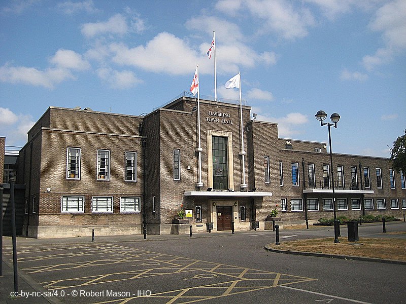
Town Hall designed by H R Collins and A E O Geens. Long low two-storey brick facade with a taller central section.
Built in 1937 and opened that year to coincide with Romford attaining Borough status. Now serves the London Borough of Havering.
Further Reading and References:-
No references for this site
Help us improve this entry
Grid Ref :- TQ 51400 89194
Co-ordinates :- Lat 51.581276 , Long 0.183705
Local Authority :- Havering London Borough Council
Pre 1974 County :- Essex
Site Status :- Listed - Grade II
Historic England List No :- 1245551,
Site Condition :- Operational site, in use for original purpose
Site Dates :- 1937 -
Town Hall designed by H R Collins and A E O Geens. Long low two-storey brick facade with a taller central section.
Built in 1937 and opened that year to coincide with Romford attaining Borough status. Now serves the London Borough of Havering.
The compilers welcome corrections or additional information on all sites.
Any information provided will be verified before appearing on the web site.
Email comments
Contributor :- GLIAS Database - 2 June 2018
Copyright :- cc-by-nc-sa 4.0 © GLIAS Database
Copyright :- cc-by-nc-sa 4.0 © GLIAS Database