Industrial History Online
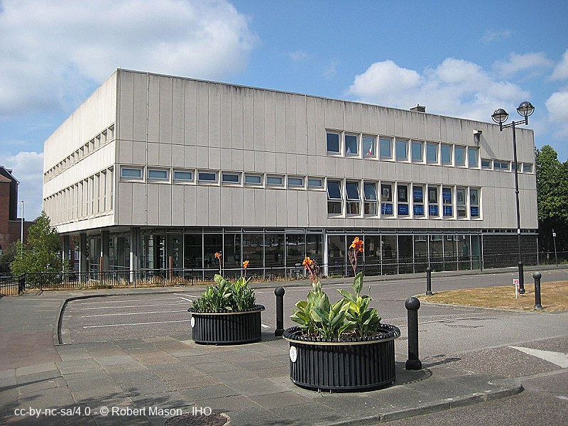
Romford Central Library
Key Words :- library
Address :- St Edwards Way, Romford, London, Greater London, RM1 3AR
Grid Ref :- TQ 51388 89144
Co-ordinates :- Lat 51.58083 , Long 0.183511
Local Authority :- Havering London Borough Council
Pre 1974 County :- Essex
Site Status :- Site extant - No Protection
Site Condition :- Operational site, in use for original purpose
Site Dates :- 1965 -
Description and History of Site:-
Public library built in 1964. By Essex County architect Harold Connolly.
Three storey concrete and glass - first and second storeys project forward / supported on columns.
Further Reading and References:-
https://www.layersoflondon.org/map/records/london-borough-of-havering-central-library-romford
Help us improve this entry
Grid Ref :- TQ 51388 89144
Co-ordinates :- Lat 51.58083 , Long 0.183511
Local Authority :- Havering London Borough Council
Pre 1974 County :- Essex
Site Status :- Site extant - No Protection
Site Condition :- Operational site, in use for original purpose
Site Dates :- 1965 -
Public library built in 1964. By Essex County architect Harold Connolly.
Three storey concrete and glass - first and second storeys project forward / supported on columns.
https://www.layersoflondon.org/map/records/london-borough-of-havering-central-library-romford
The compilers welcome corrections or additional information on all sites.
Any information provided will be verified before appearing on the web site.
Email comments
Contributor :- GLIAS Database - 2 June 2018
Copyright :- cc-by-nc-sa 4.0 © GLIAS Database
Copyright :- cc-by-nc-sa 4.0 © GLIAS Database