Industrial History Online
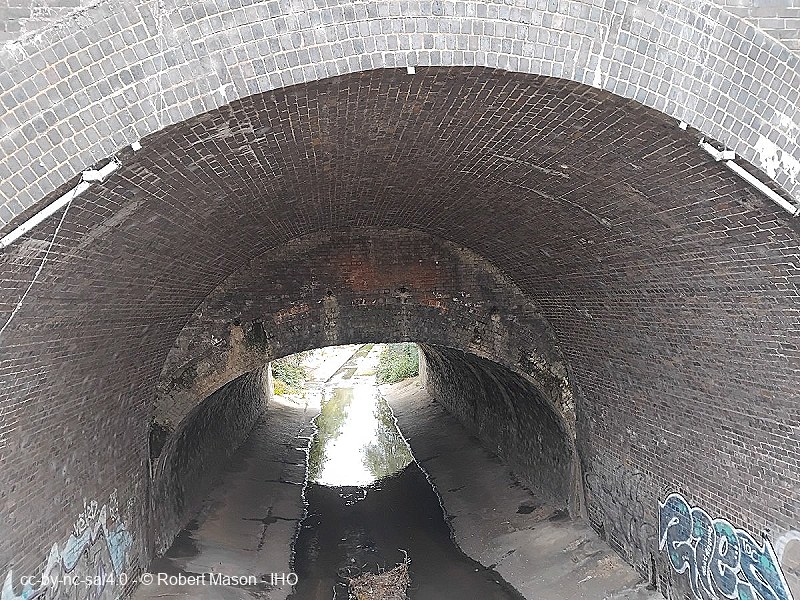
River Rom railway arch
Key Words :- tunnel
Address :- Exchange Street, Romford, London, Greater London
Grid Ref :- TQ 5122 8839
Co-ordinates :- Lat 51.5741 , Long 0.180764
Local Authority :- Havering London Borough Council
Pre 1974 County :- Essex
Site Status :- Site extant - No Protection
Site Condition :- Operational site, in use for original purpose
Description and History of Site:-
Brick-lined tunnel or archway under the railway embankment beyond the western end of the Romford Station platforms.
The river is culverted under the old (now re-developed) brewery site to the north, and Exchange Street - north end visible from public footpath running along north side of railway / Exchange Street.
The river continues southwards from the railway open to the sky.
Further Reading and References:-
No references for this site
Help us improve this entry
Grid Ref :- TQ 5122 8839
Co-ordinates :- Lat 51.5741 , Long 0.180764
Local Authority :- Havering London Borough Council
Pre 1974 County :- Essex
Site Status :- Site extant - No Protection
Site Condition :- Operational site, in use for original purpose
Brick-lined tunnel or archway under the railway embankment beyond the western end of the Romford Station platforms.
The river is culverted under the old (now re-developed) brewery site to the north, and Exchange Street - north end visible from public footpath running along north side of railway / Exchange Street.
The river continues southwards from the railway open to the sky.
The compilers welcome corrections or additional information on all sites.
Any information provided will be verified before appearing on the web site.
Email comments
Contributor :- GLIAS Database - 2 June 2018
Copyright :- cc-by-nc-sa 4.0 © GLIAS Database
Copyright :- cc-by-nc-sa 4.0 © GLIAS Database