Industrial History Online
Stave Hill
Key Words :- docks
Viewing the Site :- on foot
Address :- Timber Pond Road, Surrey Docks, London, Greater London, SE16 6AX
Grid Ref :- TQ 36109 79847
Co-ordinates :- Lat 51.50118 , Long -0.040449
Local Authority :- Southwark London Borough Council
Pre 1974 County :- London
Site Status :- Site extant - Protected status unknown
Site Condition :- Operational site, in use for original purpose
Site Dates :- 1985 -
Description and History of Site:-
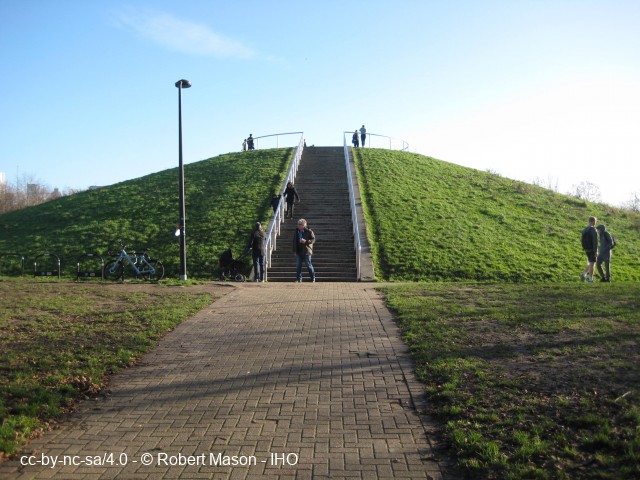
Stave Hill is a man made mound, about 9m/30ft in height, made largely from rubble left over from the redevelopment of the Surrey Commercial Docks in 1985.
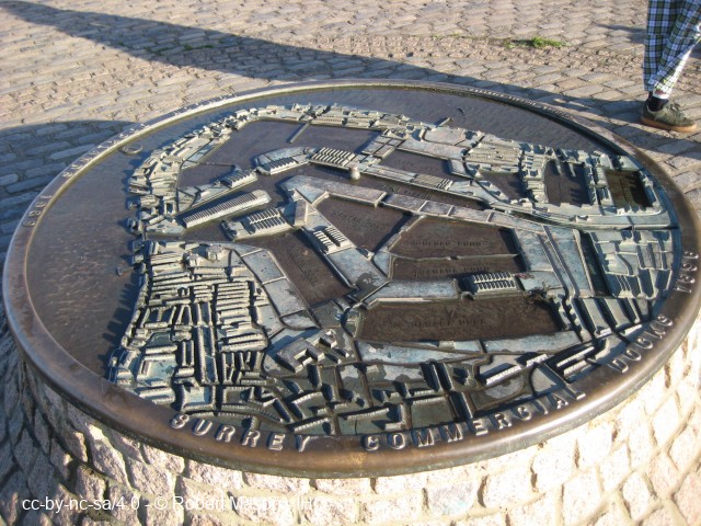
At the top there is a relief map of the former docks in cast bronze by Michael Rizzello.
Good viewpoint for the surrounding area.
Further Reading and References:-
https://www.tcv.org.uk/london/urbanecology/urban-ecology-sites/stave-hill-ecological-park/
Help us improve this entry
Grid Ref :- TQ 36109 79847
Co-ordinates :- Lat 51.50118 , Long -0.040449
Local Authority :- Southwark London Borough Council
Pre 1974 County :- London
Site Status :- Site extant - Protected status unknown
Site Condition :- Operational site, in use for original purpose
Site Dates :- 1985 -
Stave Hill is a man made mound, about 9m/30ft in height, made largely from rubble left over from the redevelopment of the Surrey Commercial Docks in 1985.
At the top there is a relief map of the former docks in cast bronze by Michael Rizzello.
Good viewpoint for the surrounding area.
https://www.tcv.org.uk/london/urbanecology/urban-ecology-sites/stave-hill-ecological-park/
The compilers welcome corrections or additional information on all sites.
Any information provided will be verified before appearing on the web site.
Email comments
Contributor :- Robert Mason - 22 December 2021
Copyright :- cc-by-nc-sa 4.0 © Robert Mason
Copyright :- cc-by-nc-sa 4.0 © Robert Mason