Industrial History Online
Slate Wharf
Key Words :- wharf
Address :- Porthmadog, Gwynedd
Grid Ref :- SH 5685 3795
Co-ordinates :- Lat 52.919835 , Long -4.130628
Local Authority :- Gwynedd Council
Pre 1974 County :- Caernarfonshire
Site Status :- Listed - Grade II
Historic England List No :- 4409,
Description and History of Site:-
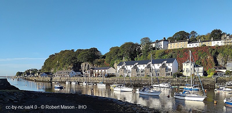
A long wharf approximately 650m long and oriented roughly north-south, of battered coursed stone in large blocks, with stone steps at the north end by the Madoc Yacht Club, and a slipway at the south end.
The north end of Slate Wharf was built by the Welsh Slate Company, who began transporting slates on the Ffestiniog Railway in 1839, and is shown on the 1842 Tithe map.
Slate Wharf had been lengthened to its present extent by 1871.
Further Reading and References:-
No references for this site
Help us improve this entry
Grid Ref :- SH 5685 3795
Co-ordinates :- Lat 52.919835 , Long -4.130628
Local Authority :- Gwynedd Council
Pre 1974 County :- Caernarfonshire
Site Status :- Listed - Grade II
Historic England List No :- 4409,
A long wharf approximately 650m long and oriented roughly north-south, of battered coursed stone in large blocks, with stone steps at the north end by the Madoc Yacht Club, and a slipway at the south end.
The north end of Slate Wharf was built by the Welsh Slate Company, who began transporting slates on the Ffestiniog Railway in 1839, and is shown on the 1842 Tithe map.
Slate Wharf had been lengthened to its present extent by 1871.
The compilers welcome corrections or additional information on all sites.
Any information provided will be verified before appearing on the web site.
Email comments
Contributor :- Robert Mason - 2 September 2026
Copyright :- cc-by-nc-sa 4.0 © Robert Mason
Copyright :- cc-by-nc-sa 4.0 © Robert Mason